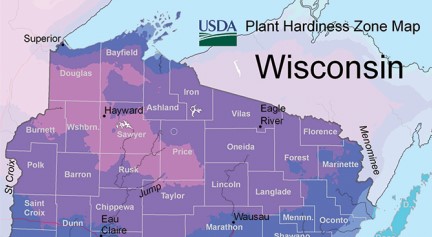
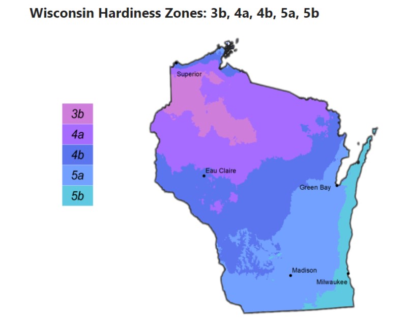
Wisconsin has a range of plant hardiness zones from 3a to 7b. The northern part of Wisconsin, including cities like Ashland, Hayward, and Rhinelander, are in zone 3a, with average minimum temperatures of -40 to -35 degrees Fahrenheit (-40 to -37.2 degrees Celsius). The central part of Wisconsin, including cities like Wausau, Stevens Point, and Wisconsin Rapids, are in zones 4a to 4b, with average minimum temperatures ranging from -30 to -20 degrees Fahrenheit (-34.4 to -28.9 degrees Celsius).

The southern part of Wisconsin, including cities like Milwaukee, Madison, and La Crosse, are in zones 5a to 6a, with average minimum temperatures ranging from -20 to -10 degrees Fahrenheit (-28.9 to -23.3 degrees Celsius). Finally, the extreme southeastern part of Wisconsin, including cities like Kenosha, Racine, and Milwaukee, are in zone 6b to 7a, with average minimum temperatures ranging from -5 to 5 degrees Fahrenheit (-20.6 to -15 degrees Celsius). It’s important to keep in mind that these are just averages, and temperatures can vary widely depending on the specific location, elevation, and microclimate.

The map above shows the different plant hardiness zones in Wisconsin, as defined by the United States Department of Agriculture (USDA). The zones range from 3a (coldest) to 7b (warmest), and are determined by average annual minimum temperatures.
To find out which zone you are in, you can look for your location on the map or enter your zip code on the interactive USDA Plant Hardiness Zone Map available on their website. This will help you choose the plants that are most likely to thrive in your area.
